Historical site features
Honoring historic networks
The Walton Center is transected by a functioning waterway that has brought water to this site and surrounding areas for more than 2,000 years. This open ditch provided water power for the Hayden Flour Mill and follows the path of ancient canals that came before it. The Salt and Verde rivers provide water to the Valley and starting in 1903, the Bureau of Reclamation built dams to provide water storage and reliable irrigation water supplies to the Salt River Valley canal systems. Salt River Project has operated and maintained the canal systems, dams and reservoirs on behalf of the Bureau since 1917. Historically the ditches not only provided reliable water for a robust agricultural community, but also offered relief from the summer heat for early residents.

In Harmony with History: The building was designed in harmony with the historic site features of the rail spur and canal. The base of the building appears to “straddle” these features while giving ample room for the rail spur and canal to be enjoyed by visitors.
Native heritage
Long before ASU and Tempe occupied this place, the land was home to people, including the ancestors of the Akimel O’Odham (River People) who still live in the Salt and Gila river valleys today, as well as ancestors of the Hopi who today inhabit portions of northeastern Arizona. The inhabitants of this place brought irrigation water from the Salt River and cultivated farm fields. The footprints of the ancestors – the archaeological evidence of farming and habitation – are deeply important to present-day Native people.
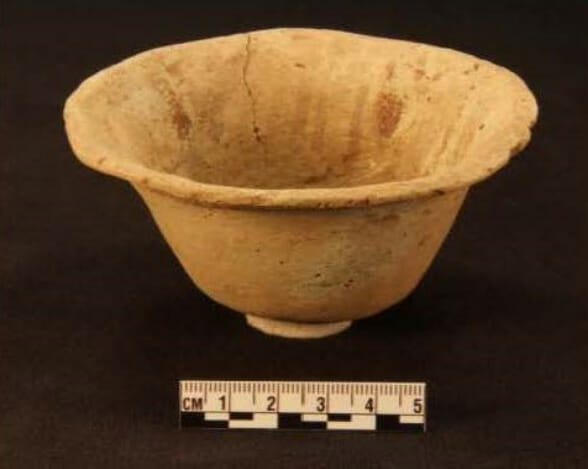
This artifact is a Sacaton flare rim bowl (circa A.D. 950-1150) excavated from the building site. It measures 5.5 cm tall with a diameter of 10.5 cm. The open-quartered layout and design execution style are attributed to Sacaton Red-on buff bowls.
Site archaeology
Approximately 4 feet of dirt was removed from the northeast corner of the site, revealing irrigation canals dating between 950 and 1450. Archaeologists recovered evidence that maize (corn), cotton and squash were cultivated here and agave hearts and cholla buds gathered from surrounding desert areas were processed for food and trade. Combined with the later historic features found on the site, this demonstrates the history of human occupation of Tempe since time immemorial – from ancestral farmlands to a place dedicated to industrial, commercial, education and scientific growth with a prominent role in local, national and international markets.
A history of convergence
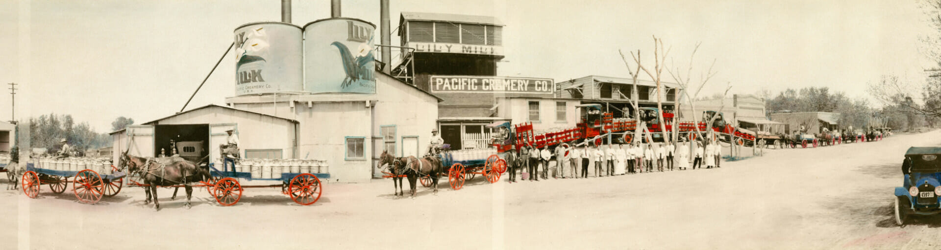
This site has a unique history of being connected to larger networks that, over time, transported resources and people. Originally, the first inhabitants built an extensive system of canals to convey water to crops in the Salt River Valley. Later, the Maricopa and Phoenix Railroad company built rail lines through Phoenix and Tempe to transport goods to the region. This included a rail spur line that linked the Creamery (now Four Peaks Brewing) in Tempe to the greater Union Pacific network and markets in downtown Phoenix. The first coast-to-coast all-weather highway ran parallel to the canal and linked San Diego, CA with Savannah, GA. It was later designated as US 80 or the Bankhead Highway. Finally, the Valley Metro Rail built the light rail to rapidly connect the greater Phoenix metro area. All of these networks can be seen and experienced on the east side of the site today.
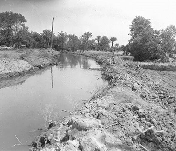
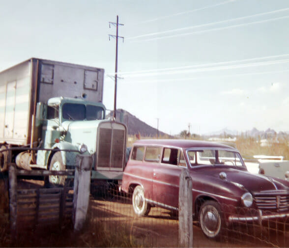
This picture shows what the canal that crosses this site looked like in 1962, but the ditch’s roots are far older. The first inhabitants of this place engineered and constructed the first canals by hand. Later settlers refurbished some of the older canals in the late 19th century. These same canals continue to provide water to Tempe today. Image courtesy of SRP Archives.
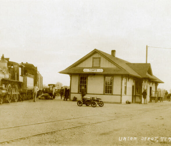
Rail car of the Maricopa and Phoenix Railroad seen stopped at Tempe Depot located at 5th Street and Willow (now College Ave). Portions of the Mesa Branch, also known as Creamery Branch, can be seen on site today.
Bankhead Highway was a cross-country automobile route started in the early 1900’s. It spanned from Savannah, GA to San Diego, CA. Eighth street in Tempe is among the last original paths of the highway in Tempe.
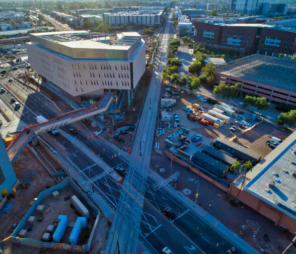
Today the site is bounded by a multi-modal Valley Metro station on the south and linked via a new pedestrian bridge to the Novus Innovation Corridor and the ASU athletic venues to the north.