The Martin Lab
Our lab explores the functional biogeography of forests, coastlines and reefs.
We conduct field and laboratory studies of functional traits in combination with airborne and satellite data aimed at developing biodiversity and remote-sensing linkages to understand patterns and fundamental processes of ecosystems at scales that can inform conservation and management. Our research focuses on understanding the patterns and processes that underpin the functional diversity of life from land to sea.
Martin Lab programs

Spectranomics
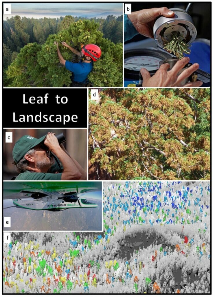
Mapping the biodiversity and functioning of forests and coral reefs is critical to understanding how best to conserve and manage them in a changing world. Advanced Global Airborne Observatory (GAO) mapping technology has reached performance levels required for operational monitoring of forest and reef biodiversity and functional properties from the air. However, spectral-chemical libraries are needed to advance our understanding further and to make maximum use of the technology.
Our approach called Spectranomics integrates canopy chemical and spectral properties in a phylogenetic (tree-of-life) context that advances current GAO and future satellite mapping techniques based on high-fidelity imaging spectroscopy. Our team has developed the world’s first Spectranomics Database, Sample Library and Frozen Forest, numerous and widely used field and laboratory protocols and a plethora of publications that link plant canopies to their spectroscopic and chemical properties. The Spectranomics Database is a critical step required to support regional and global biodiversity mapping efforts in the coming decades.
Functional Diversity of Hawaiian Ecosystems
The Big Island of Hawaii presents a 2.5 million acre living laboratory to study functional diversity across a huge range of bioclimatic, geologic, and land-use gradients. Current studies occur within GDCS’s Pacific Ridge-to-Reef Program and at the ASU Kohala Institute.
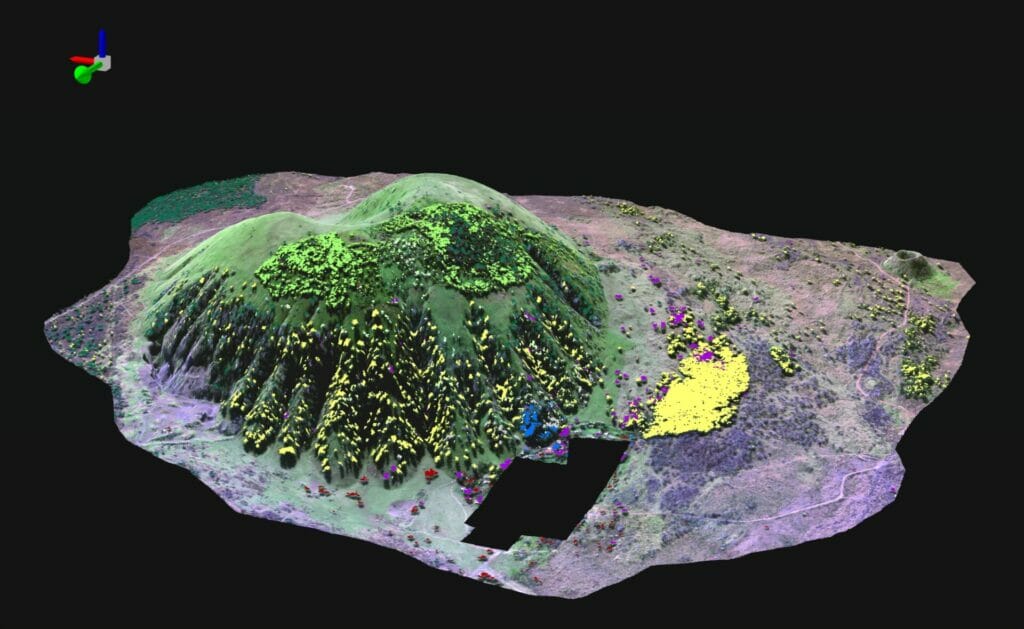
Forest Vulnerability in Sequoia Kings Canyon National Park, California
Recent extreme droughts in California have provided an opportunity to measure and map forest functional response to drought at leaf-to-landscape scales. We link field and remote-sensing data to reveal species-specific patterns in canopy water content and also to develop and test forest vulnerability maps with the goal of guiding forest management actions.
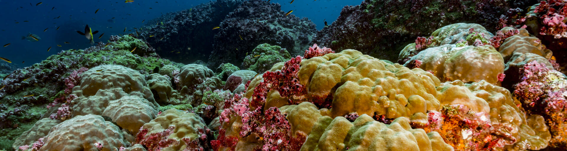
Global CoralSpec
CoralSpec, short for Coral Spectranomics, is a new project to develop a spectral library of critical habitat-forming hard coral species on our planet. This project aims to visit as many coral reefs as possible to collect field-based spectral measurements of known habitat-generating hard corals and to collect samples for subsequent chemical analyses in our laboratory. The chemical sampling component is key to the interpretation of the spectral data taken by current airborne and future satellite-based mapping technologies.
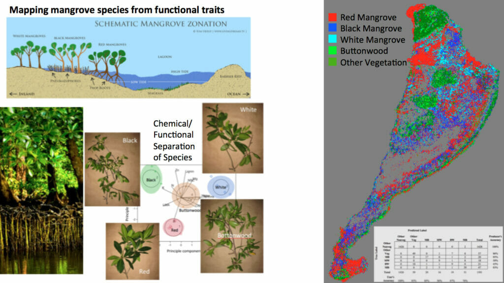
Coastline Vegetation
Mapping mangroves species composition for management and monitoring linking field, airborne and satellite data in Belize and Mexico.