Monsoon season
Arizona monsoon season
The monsoon season typically begins in early June when active thunderstorms build in central and southern Mexico. In mid- to late June, the thunderstorms move toward the International Border and into Arizona. The monsoon is a season where the dry, westerly winds (winds coming from the west) that typically persist through fall, winter and spring shift to moist, southerly winds (winds coming from the south). The incoming moisture helps build thunderstorm activity across the state.
Terminology: The term “monsoon” refers to a seasonal time of year where thunderstorms are more likely to occur. A monsoon is NOT a thunderstorm, but the monsoon season can help build thunderstorms.
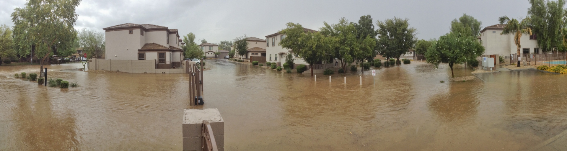
Monsoon thunderstorm activity accounts for roughly half of the annual precipitation in central and northern Arizona, and two-thirds to three-fourths of the annual precipitation in southern Arizona. The short-lived, intense monsoon thunderstorms can often cause flash flooding in areas with steep terrain, low-lying roads, or normally dry washes. Lightning, hail, dust storms and strong winds are common during the monsoon season.
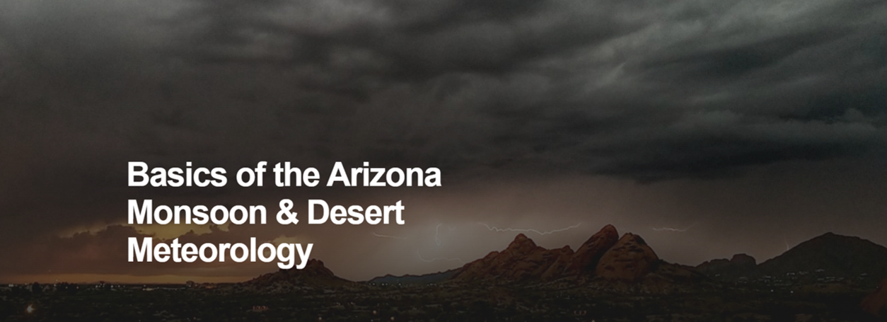
Basics of the Arizona monsoon


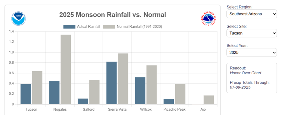
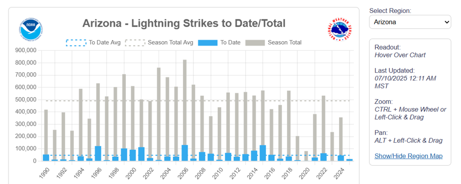
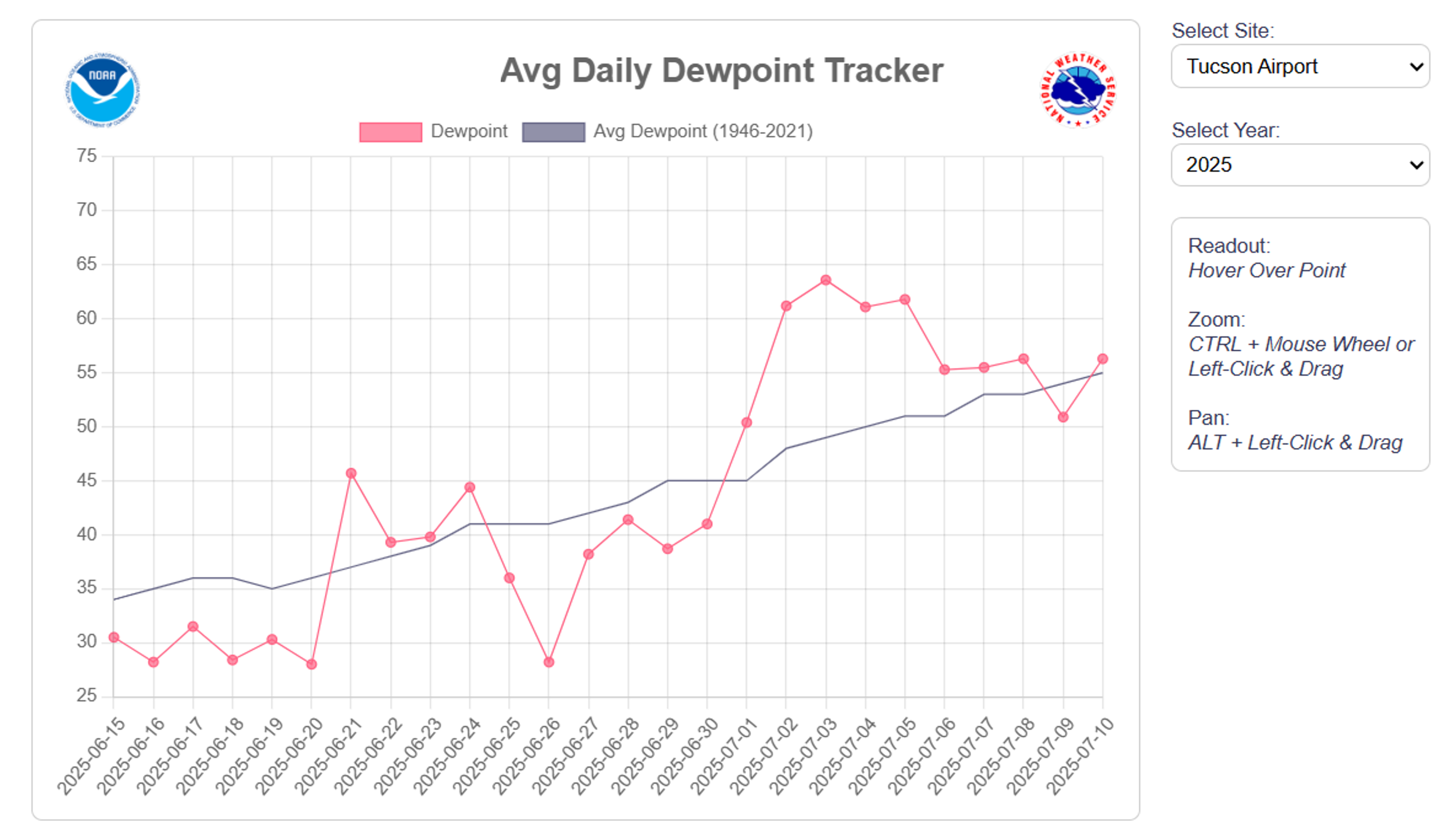
Total monsoon precipitation (to date)

Monsoon data
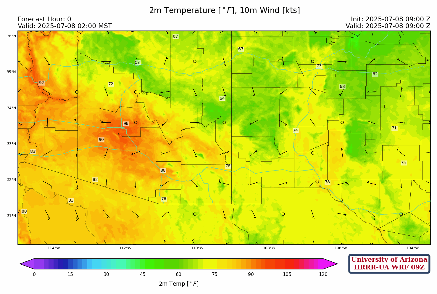
Arizona regional WRF model forecasts
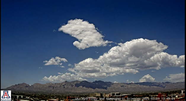
Southern AZ cloud cams