Data and maps
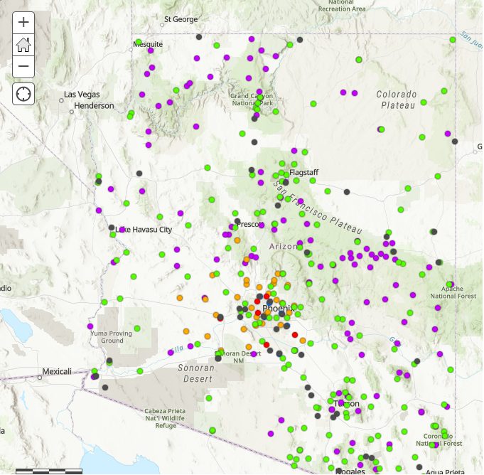
Arizona weather stations
Phoenix Dust Storm
(PHX-DUST) Scale

Public data access
NWS Phoenix area stations
NWS Flagstaff area stations
NWS Tucson area stations
NWS Kingman area stations
Climate charts
NWS Central AZ stations
NWS N Arizona stations
NWS SE Arizona stations
NWS NW Arizona stations
Clickable ASOS data
Clickable Long-term data
Clickable CO-OP data
Clickable Hydro data (DCP)
Clickable Road data (RIWS)
Interactive map AZ ASOS IDs
Global Hourly Integrated Surface Database Hourly Data
Historical Observing Metadata Repository NCEI metadata
What is ASOS?
Automated Surface Observing System
XM ACIS2 Data Station Data
SC ACIS2 Station Data
Threaded Station Extremes Online
National High and Lows
Global Historic Climatology Network Online
NCEI Climate Data Online
NCEI Storm Event Reports Online
Iowa Environmental Mesonet Online
Arizona Meteorological Network AZMET
Flood Control District of Maricopa County
Google Map
Weather Sensor Data Page
Weather Data Plotter
Single Sensor Data
Raw Single Sensor Data
Pima County Regional Flood Control District
Google Map
Precipitation and Streamflow Data
Coconino County ALERT Display
Additional maps
Forecast maps
COD Analysis Products Maps
Global Forecast Models Maps
US Forecast Models Maps
Wind maps
Wind Map United States
Earth Nullschool Wind Map Global
Lightning maps
Daily Lightning Climatology Map United States
Climate maps
SERCC Rankings Current Maps
MRCC Tools Cli-MATE Maps
ACIS Climate Archive Maps
U.S.Climate Normal PRISM Maps
U.S. Temperature and Precipitation Climate.gov Maps
NCEP Reanalysis Maps